Table of Contents
Major Planetary Zones | (Twin) Sections of the Habitual Belt | Regions | Settlements
HOPE
 }}
Overview
Hope is an agricultural-first ExoHuman settlement on the lush eastern bank of the Arla River in the Asari Region (Eastern Equatorial Section) of the Habitual Belt on VOI 700 D. Founded on 24 March 2626 during the Beta Age as a loose grid of farms rather than a planned town, it grew into the “Granary of the People.”
- Population (2635 census): 4 000
- Gamma Age output (2635): 6 000 t grain from 1 000 ha • 2 water-mills • Federal Hoo Breeding & Training Station • Federal Veyra Breeding & Training Station
Its organic street plan — two long spines (Seedway & Sidestreet) crossed by three east-west roads — makes Hope the only settlement that ignores the ring blueprint of the HSP.
Geographical Position & Microclimate
Hope’s fertile terraces sit 80 km north of New Kourou, framed by tropical forest with the fog - veiled Atrana peaks to the east and Tijonara ridge to the west. Temperatures hover 20–30 °C; daily showers and Arla River mists keep soil perpetually moist, while steady equatorial airflow prevents stagnation.
Social Composition of Hope
Beta Age (2626–2630)
Hope began as scattered homesteads and work crews that coalesced into a farm-first town. Households were stable by frontier standards; population swelled at planting and harvest.
- Households & Children: Family-centered from the start. A noticeable share of residents were children; schooling existed early (combined primary/high), and apprenticeships to millers, potters, ranchers, and couriers were common.
- Gender & Tenure: Mixed workforce with many multi-year homesteaders; seasonal hands rotated in for sowing/harvest and during ranch culls.
- Workforce Mix: Predominantly agriculture and river trades — grain farmers, ranch hands, bargers/fishers, kiln crews, and millers — with a light layer of market stalls, couriers, and local administration.
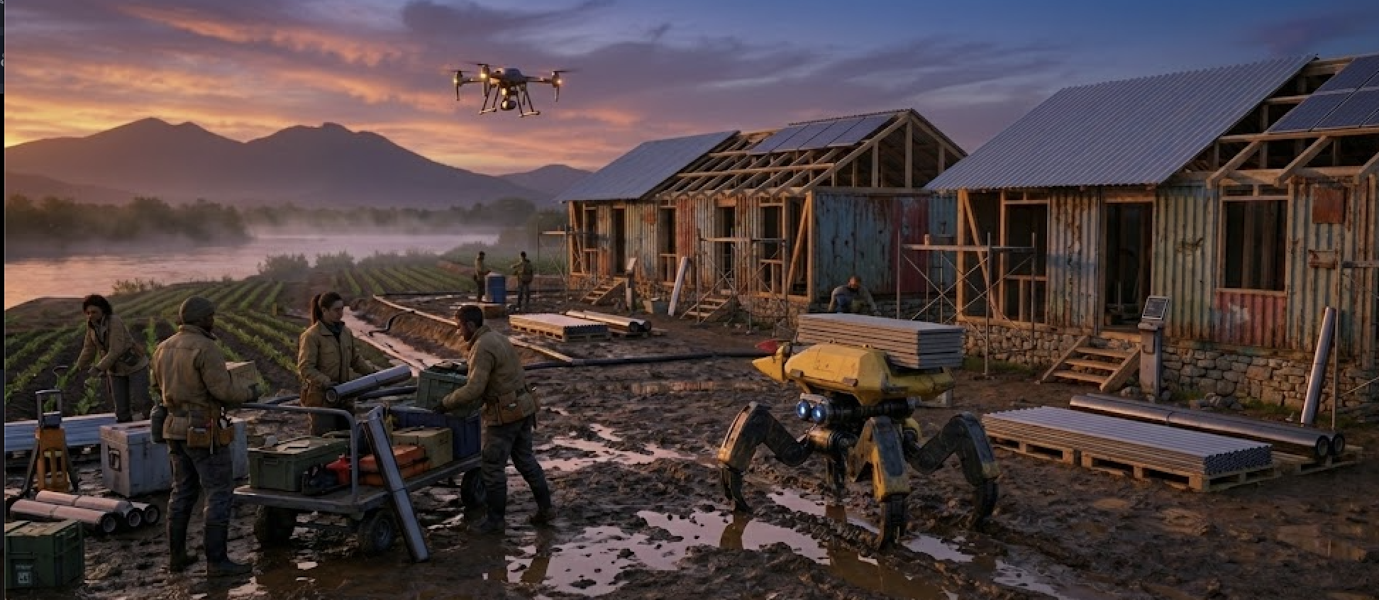
- Automation footprint: Service Bots and Manual Labor Bots supported field prep, irrigation fixes, and mill handling; Seed Drones mapped plantings. Even so, hand labor defined the rhythm of work.
Gamma Age (2631– )
Nationalization transformed Hope into the Confederation’s granary. Ranching, hunting, and fishing ceased; fields and processing were folded under federal quotas.
- Households & Children: Families remain present and stable in longhouse blocks; schools operate continuously under standardized curricula. Extended households (multi-generational, work-brigade roommates) are common near fields and mills.
- Work Assignments & Tenure: GAIA places most adults in agricultural brigades, mills, the Federal Kitchen, or the breeding & training stations; postings often run multi-year with seasonal surges. Post-war resettlers from Arla Town and smaller farmsteads are part of the mix.
- Workforce Mix: Centralized farming (1 000 ha under the Federal Food Plant), milling, food processing, and animal training dominate; small municipal services, health, and allotment operations round out the town.
Political Orientation
- Beta Age –Formal parties hadn’t arrived. Hope’s “politics” lived on granary porches and under market awnings — settlers fresh from the Last Frontier carried two memories at once: the ship’s sleek comfort and the shock of the crash. The town leaned agrarian and cooperative: irrigation rosters were hammered out at barter fairs, seed swaps doubled as town halls, and the Contact Person read the room for consensus more than counted votes. Tensions were practical, not ideological — homesteaders guarding autonomy vs. traders courting New Kourou contracts; grain farmers vs. ranch hands and river crews over seasons, grazing, and water rights. Lottery days from the Land Allocation Office felt like festivals, and winners owed their neighbors a fence-raising or ditch-cut. The mood was family-first, pragmatic, and stubbornly optimistic: fix the canal, bring in the harvest, and let the ledgers catch up later.
- Gamma Age – A true swing town: First Communards dominated, later Individualist Mayor Decker Bolton (elected 2634) pushes privacy-first, anti-bureaucracy policies, fuelling factional tension.
Local Governance
Beta Age
- Local government: Annually elected Contact Person of Hope
- Law enforcement: Local Guarding Troopers Station of Hope
Gamma Age
- Local government: Mayor of Hope (Decker Bolton)
- Law enforcement: Local Sheriff’s Office of Hope
Look and Feel
In the Beta Age

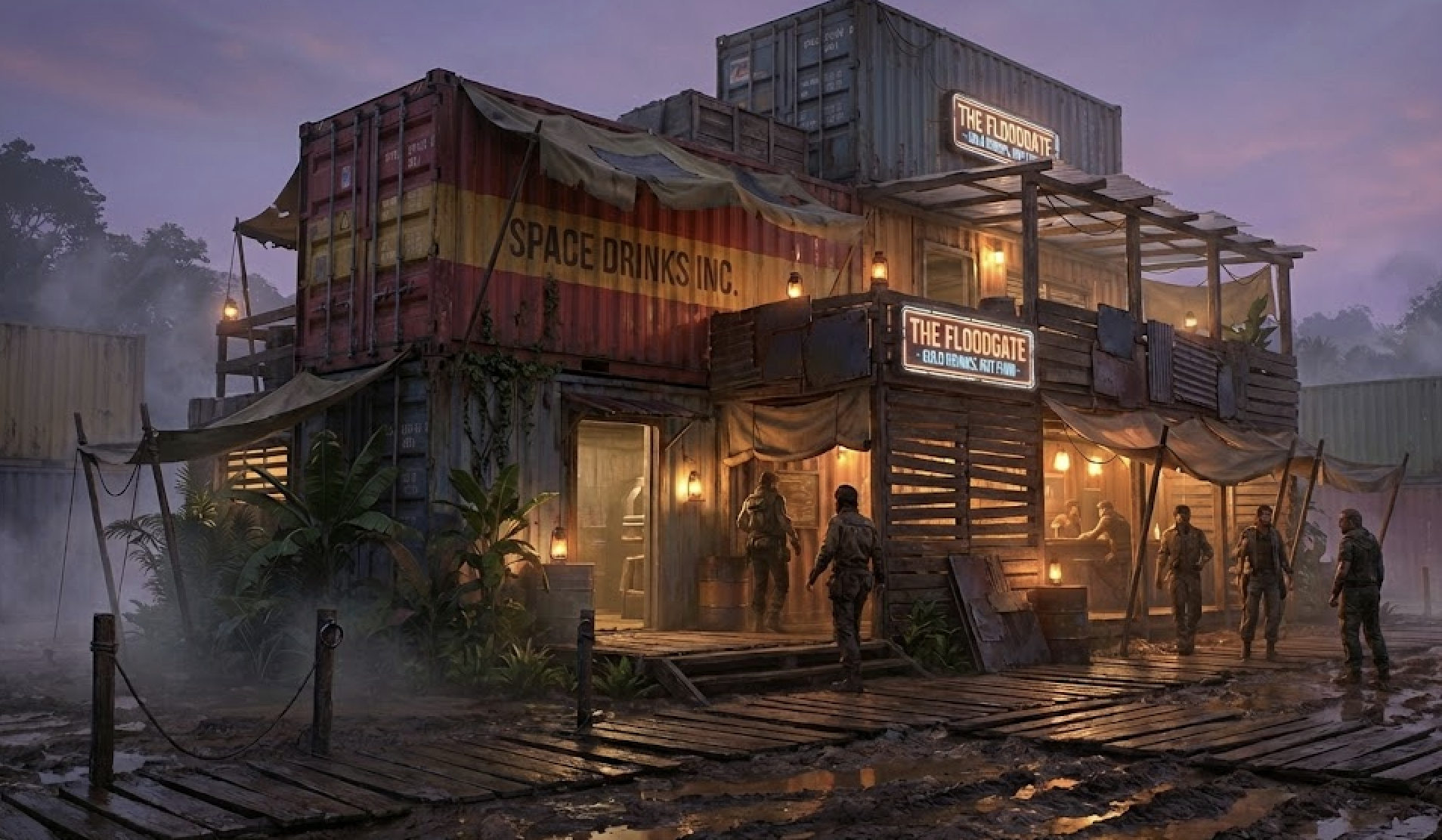
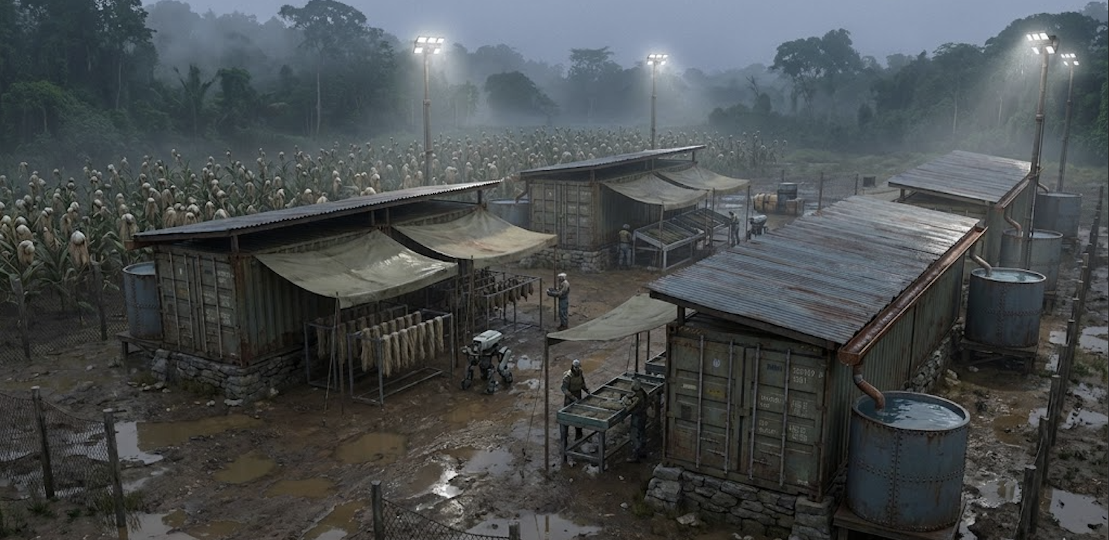
Wooden porches and river-stone granaries crowd the muddy Seedway, where carts of golden grain creak past Manual Labor Bots patching irrigation ditches and seize up for want of spare parts the next. Sprawling Hoo ranches edge the town; wranglers astride these hoofed grazers clip past Hope Meat Inc. Slaugtherhouse’s smoking sheds. Overhead, Seed Drones buzz low across emerald fields while Courier Drones ferry pottery orders between crossroads kilns and dockside stalls. River barges piloted by straw-hatted fishers unload baskets of Skyweaver Eels and Misttail Crabs; the haul races straight to The Floodgate tavern or its rowdier twin, Old Netter's Rest, where kiln-hands clink foaming mugs of Space Beer and trade rumors of fresh land grants. Kiln smoke coils into the perpetual violet twilight, mingling with wet earth, roasted maize, green lumber, and warm Hoo-leather — equal parts high-tech whir and campfire grit, every breath charged with frontier optimism.
In the Gamma Age:
Hope’s fields still ripple under perpetual twilight, but the rows now host only hardy native grains and tubers — every furrow follows a strict organic rota logged by the Federal Food Plant. Fishing boats lie beached, the Slaughterhouse stands silent, and rusting drone carcasses dangle from barn rafters as reminders that automation and meat production are both forbidden under the Peace Treaty. Exohumans bend to the work themselves, all ranches, potteries, and kilns have been nationalized, wages paid in allotment coupons rather than coin. Travel permits choke off the old caravan traffic — frontier bravado has been replaced by tidy ledgers and quota boards. Yet on moonless evenings, lamps wink behind false walls of shuttered cottages: in cramped speakeasies nicknamed “seed-banks,” Individualist farmers whisper over contraband Space Beer about turning those silent Labor Bots back on — and seeding a revolution alongside the grain …
Town Structure
Hope’s layout departs from the six-ring model of the Human Settlement Plan. Instead, three primary north–south arteries — Riverfront Way (riverside commerce), Seedway (inland commerce) and Sidestreet (residential) — span roughly one kilometer each. These thoroughfares are intersected by three equally spaced east–west crossroads— Northern Crossroad, Central Crossroad, and Southern Crossroad — around which key facilities cluster (mills at Northern, the distillery at Central, and pottery rows at Southern).
- Riverfront Way: Runs directly along the riverbank
- Seedway: Parallel inland commercial street lined with shops, grain exchanges, and supply depots.
- Sidestreet: Parallel residential avenue lined with longhouse blocks and pocket gardens.
Crossroads:
- All three Crossroads (Northern, Southern, Central) feature a similar mix of manufactories, processing plants, and agricultural support facilities — reflecting Hope’s integrated agro‑industrial economy.
Reservation Addressing System
Hope uses a simple road–sector–number format, foregoing quadrant designations:
- Road Name: Seedway, Sidestreet, or one of the three Crossroads.
- Sector Prefix: North, Central, or South (for Seedway/Sidestreet) or West/East (for Crossroads, relative to Sidestreet).
- Sequential Number: Increases along the road from its western or northern terminus.
Example:
- North Seedway 7 – the seventh lot along Seedway north of Central Crossroad.
- East Central Crossroad 3 – the third address east of Sidestreet on Central Crossroad.
Town Zones & Buildings
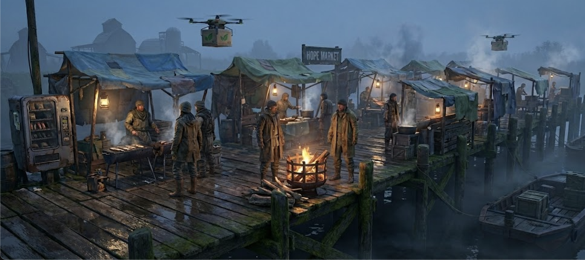
Hope’s layout reflects its organic growth — five key zones rather than concentric rings.
Shore (Riverfront)
- Gamma Age: Federal Courier Station of Hope • Federal Mills Facility
Seedway (Main Street & Central Crossroad)
Sidestreet (Residential Quarter)
- Beta Age: Stone cottages • provisional bunkhouses for farmhands, Hope Primary and High School
- Gamma Age: Expanded residential rows • gardeners’ pocket plots, Hope Elementary School, Federal News Lounge of Hope
Crossroads (Artisan Belt)
Farmbelt (Outlying Fields)
- Beta Age: Harvest Rest Cemetery Hope • several 65-ha grain farms • four Hoo ranches (e.g. Jamestown Ranch) • 5 Hekana Fields of Karabulut Garment Manufactory • Facility of Hope Mills Inc.
Town Wall
Hope is ringed by kilometres of open cropland: no wall exists — defence relies on early-warning posts and mounted patrols.
Tactical Advice for Dungeon Masters
Beta Age Hook
- Harvest of Shadows – On the eve of Hope’s maiden Zelor Grain shipment to New Kourou, the granaries on the Northern Crossroad go up in flame under the perpetual twilight. The Contact Person begs the PCs to track down the arsonists — was it Trade Guild rivals, Disillusioned ideologues seeking chaos, or the Trando Tribe? The party must gather clues among ash-streaked fields, rally Manual Labur Bot- crews to shore up the remaining stock, and foil a plot that could starve the Belt.
Gamma Age Hook
- The Fungal Ultimatum – Inspectors from the Federal Housing Agency descend on Seedway with the Peace Treaty’s mycel-block mandate, demanding that three fire-damaged facades be rebuilt in fungus-composite panels. The Individualist mayor publicly defies the order, while clandestine greenthumbs in Hope’s “seed-bank” speakeasies conspire to smuggle in illegal timber. Deputized by the Local Sheriff, the PCs must broker a settlement between hard-line inspectors, anxious farmers facing looming ration cuts, and shadowy smugglers
Related Pages and Further Information
Gamma Age
Beta Age
Exohuman settlements:
- Arla Town (Asari Region | Beta Age only)
Other settlements in Asari: